Muni map gets a makeover
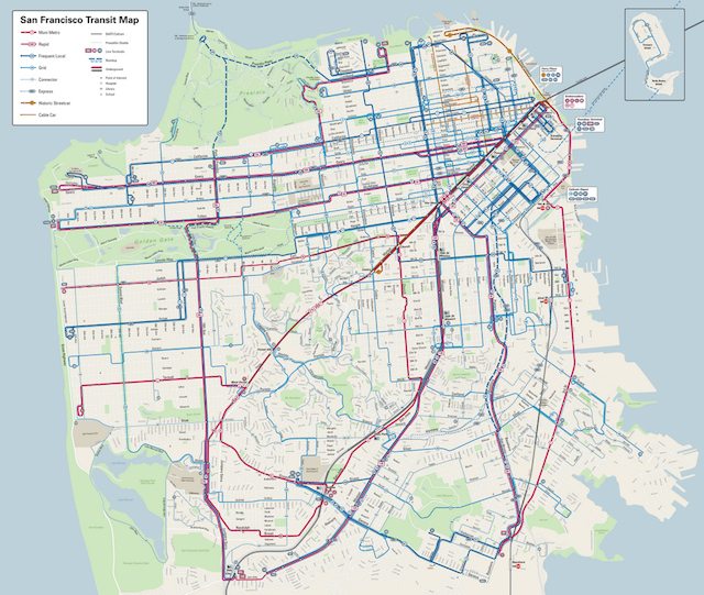
Image courtesy StreetsblogSF (click to embiggen)
There’s a new Muni map, you guys. StreetsblogSF has the story:
The complex web of San Francisco’s 82 municipal transit lines has been made more legible through a sleek new layout that will grace Muni shelters early next year. As we wrote in June, the map was developed over ten years by two volunteer cartographers, David Wiggins and Jay Primus, who also happens to be the former manager of SFPark.
The map “helps visualize the service hierarchy,” making it clear “where there’s more service, and where there’s less service,” as Muni’s operations planning and scheduling manager, Julie Kirschbaum, put it in June.
Read more over at StreetsblogSF. Still looks pretty confusing, but how else are you gonna manage such a mess?
Let us know what you think of the new map in the comments below.
Join us at Muni Diaries Live on Saturday, Nov. 8, for a night of true, hilarious, weird, and sweet stories that can only happen on Muni! Grab a ticket and we’ll see you there!
Well, the busier lines do stand out (and that’s good).
Misspells Niagara Avenue as “Niagra.” What were they thinking?